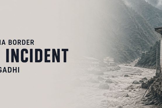
Yes, most of Nepal’s major trekking routes remain unaffected by the August 26, 2026 Rasuwa flood. The disaster was triggered by an ice-and-rock collapse that blocked the Lhende River, causing a sudden flood surge through the Bhote Koshi and Trishuli river systems.Langtang, Tamang Heritage, and Gosaikunda routes have been affected by access and infrastructure disruptions, while Everest Base Camp, Annapurna Circuit, Annapurna Base Camp and Upper Mustang were not directly affected by the flood.Trekkers should still check current route and transportation conditions before departure.
Nepal is open. The Himalayas are waiting.
The devastating Bhote Koshi and Trishuli floods of August 26, 2026 caused extensive loss of life and infrastructure in Rasuwa and downstream districts. Nepal’s Ministry of Home Affairs states that the major flood occurred at approximately 8:40 a.m. and severely affected riverbank communities in Rasuwa, Nuwakot, Dhading and Gorkha. WHO’s situation report also identifies affected communities in Chitwan and Tanahun.
Initial technical assessments indicated that an ice avalanche may have blocked the Lhende River, creating a temporary debris-dammed lake that subsequently burst, sending a major surge into the Bhote Koshi system. Authorities said further assessment was required to establish the exact sequence of events.
The flood severely disrupted the Rasuwa–Bhote Koshi–Trishuli corridor, including access toward the Rasuwagadhi border and popular destinations such as Langtang and Gosaikunda. However, the available post-flood reports do not indicate that the main trekking trails of Everest, Annapurna or Manaslu were directly hit by this event.
Nepal is open. Please do not cancel your journey to Nepal simply because of this disaster.
The Nepal Tourism Board has issued the same message internationally: “Nepal is not closed.” While some areas have been severely affected, much of the country continues to live, work, travel and welcome visitors.
For travelers who have already planned or booked an autumn journey, the most important thing is to understand the geography of Nepal and the actual location of the disaster.
Which Areas Were Directly Hit?
The primary impact zone was concentrated in Nepal’s Rasuwa district, along the Bhote Koshi and Trishuli river corridors. Key locations that sustained damage include:
- Timure: a market and customs area near the Nepal-China border that was severely affected, with homes, roads, and commercial structures destroyed
- Syabrubesi (Ward No. 5): the main gateway town for Langtang and Tamang Heritage treks, which sustained infrastructure damage and road disruptions
- Downstream communities: flood impacts extended downstream through Nuwakot, Dhading, Gorkha, and Chitwan districts as the surge moved through the Trishuli river system
- Roads and bridges: multiple routes including the Rasuwa-Syabrubesi-Timure highway and sections of the Prithvi Highway sustained damage
A Tragedy in One Corridor Does Not Mean the Whole Country Is Closed
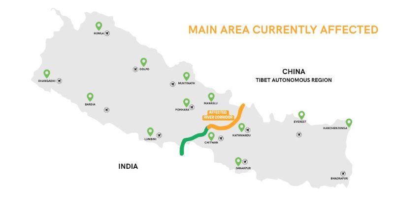
The flood’s impact on trekking is geographically confined to routes that access the Rasuwa district via Syabrubesi. The following table reflects the status as of September 1, 2026. Trekkers should confirm with their operators for real-time updates as road repair and recovery timelines evolve.
| Trek / Route | Status | Affected Element |
| Langtang Valley Trek | Access-dependant | Syabrubesi access road; gateway town damaged |
| Tamang Heritage Trail | Access-dependant | Timure corridor directly struck; key overnight stops impacted |
| Gosaikunda Trek | Access-dependent | Primary access via Syabrubesi disrupted |
| Kailash Mansarovar (via Kerung) | Temporarily Closed | Nepal-China border crossing at Rasuwagadhi damaged |
| Helambu Circuit | Unaffected | Separate road access via Kathmandu |
Operator Advisory – Langtang Update Note for Langtang trekkers: Himalayan Glacier Adventure and Travel Company advises that the Langtang walking trail itself which follows the Langtang Khola valley was not flooded. The disruption is to road access and the Syabrubesi gateway. Trekkers with bookings in late September or October should contact their operator directly; departure feasibility will improve significantly as road repair work advances.
Which Nepal Trekking Routes Are Safe and Open Right Now?
Nepal’s four flagship trekking regions – the Everest, Annapurna, and Upper Mustang areas are fully open and operating normally. These routes drain into different river systems (the Koshi basin for Everest, the Gandaki basin for Annapurna, and the Kali Gandaki for Upper Mustang) and received zero flood impact from the August 26 event.
| Trek | Status | Max Altitude |
| Everest Base Camp Trek | Open – Safe | 5,545m / 18,192ft |
| Annapurna Circuit Trek | Open – Safe | 5,416m / 17,769ft |
| Annapurna Base Camp Trek | Open – Safe | 4,130m / 13,550ft |
| Manaslu Circuit Trek | Temporarily Disrupted | 5,160m / 16,930ft |
| Upper Mustang Trek | Open – Safe | 3,870m / 12,697ft |
Nepal’s major trekking regions have not been uniformly affected by the recent floods. Everest, Annapurna, and Upper Mustang remain separate from the currently affected areas, while the Manaslu and Larke Pass routes are temporarily disrupted.
Following flooding in the Therang Khola at Namrung, the District Administration Office, Gorkha has advised trekkers to avoid the Manaslu and Larke Pass trekking routes until further notice. Trekkers should confirm current route conditions with their operator and local authorities before travelling.
All pricing above reflects Himalayan Glacier Adventure’s current rates for twin-share departure and includes certified local guides, porters, all required permits, domestic transport, teahouse accommodation in the mountains, and most meals on trail. International flights and Nepal visa fees are excluded. For the most current pricing, contact Himalayan Glacier directly or visit the individual trip pages linked below.
Your Autumn 2026 Trek Is Still On
Everest, and Annapurna are fully operational and taking trekkers right now. Limited October-November departure slots remain. Don’t let flood headlines cancel a trip that’s completely unaffected.
Check Availability →
Himalayan Glacier Is Operating Everest Treks Normally
As of September 1, 2026, Himalayan Glacier has two Everest trekking groups currently operating in the Everest region. Both groups are proceeding as scheduled, with our ground team operating normally and without any disruption on the ground.
This provides a real-time indication that the Everest Base Camp trekking route remains accessible and operational despite the recent flooding in the Nepal–China border region. The August 26 flood was geographically concentrated in the Rasuwa–Bhote Koshi–Trishuli corridor and did not affect the Everest trekking region.
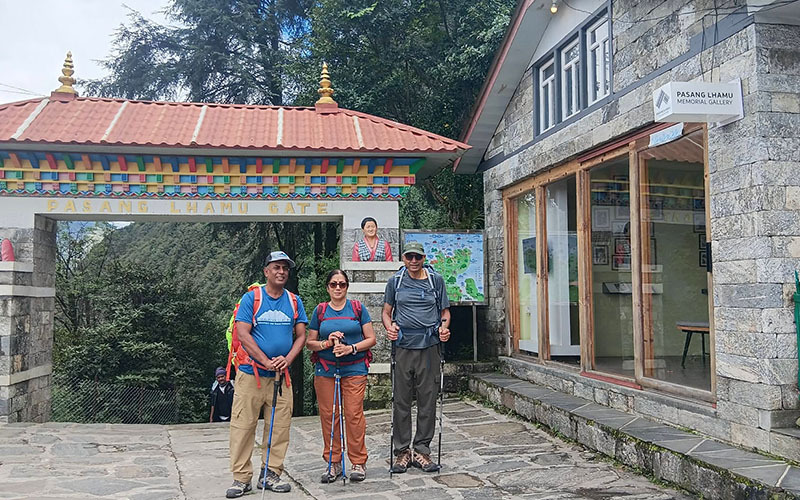
If Your Everest Trip Is Booked, Do Not Cancel Because of Rasuwa
Everest lies in a completely different part of Nepal.
The Everest region—including major trekking routes such as Everest Base Camp, Gokyo and the Three Passes—has been reported as unaffected by the Rasuwa flood.
If your trip is already booked, speak with your trekking company and confirm current conditions.
But cancelling an Everest journey because of a disaster on the Tibet-border corridor would generally confuse two completely different geographical regions.
Why Are Everest, and Annapurna Unaffected by the Floods?
Understanding the geography of Nepal’s river systems makes clear why the August 2026 border flood had no impact on the country’s major trekking routes. Nepal’s mountain drainages flow into three primary river basins: the Koshi in the east, the Gandaki in the center, and the Karnali in the west.
1. Everest Region (Koshi Basin – Eastern Nepal)
The Everest region lies in the Koshi basin, draining eastward through the Dudh Koshi river. The trail to Everest Base Camp – beginning from Lukla (2,860m / 9,383ft), passing through Namche Bazaar (3,438m / 11,280ft), and ascending to Base Camp (5,364m / 17,598ft) and Kala Patthar (5,545m / 18,192ft) – is entirely separated from the Bhote Koshi corridor by several major ridgelines. The August 26 flood had no hydrological connection to this watershed.
2. Annapurna Region (Gandaki Basin – Central Nepal)
The Annapurna trekking region lies within the Gandaki basin but is geographically separate from the Rasuwa–Bhote Koshi–Trishuli corridor affected by the August 26 flood. The Annapurna Circuit and Annapurna Base Camp routes were not directly affected by that event.
3. Upper Mustang (Kali Gandaki – Rain Shadow Zone)
Upper Mustang sits in the high-altitude rain shadow north of the Annapurna massif, drained by the Kali Gandaki river. The region sits at an average elevation of 3,500m-4,000m / 11,483ft-13,123ft and receives extremely low precipitation – a climate feature that actually made it one of Nepal’s most consistently accessible trekking areas during monsoon months. Flood risk in Upper Mustang is negligible.
What Should Trekkers with Existing Bookings Do?
The right action depends entirely on which route a trekker is booked on. The following guidance addresses the most common situations trekkers and travelers are currently facing:
If Booked on Everest, Annapurna, or Upper Mustang
No action is required. These routes are operating normally. Trekkers should proceed with existing plans without modification. Himalayan Glacier’s ground team is active on all of these routes, and no delays, trail closures, or safety concerns exist in these regions as of September 2026.
If Booked on Langtang Valley Trek
Trekkers with Langtang departures in September 2026 should contact their operator immediately to assess road access conditions. Early October departures are more likely to proceed as road repair work on the Syabrubesi access route advances. The walking trail itself was not damaged. Himalayan Glacier recommends direct contact to assess each individual departure date.
If Booked on Tamang Heritage Trail or Gosaikunda Trek
Both routes are currently affected due to access disruptions and ongoing recovery efforts in the affected corridor. Travelers are advised to consult their trekking operator for the latest conditions and consider rebooking or alternative trekking routes until access is restored.
An excellent alternative is the Gosaikunda Trek, which approaches the region from the Kathmandu side via Sundarijal–Chisapani–Tharepati and avoids the currently affected Syabrubesi corridor. The route passes through the scenic Helambu region before reaching the sacred Gosaikunda Lake at 4,380 m, offering a rewarding combination of Himalayan scenery, mountain villages, and cultural experiences.
Travel Insurance and Date Adjustments
Trekkers requiring date changes due to the Rasuwa floods should document the following for insurance and booking purposes:
- Event date: August 26, 2026 – Flash flood, Rasuwa district, Nepal-China border area
- Affected routes: Langtang Valley Trek, Tamang Heritage Trail, Gosaikunda Trek, Kailash Mansarovar Yatra (via Kerung border crossing)
- Unaffected routes: Everest Base Camp, Annapurna, Upper Mustang, and all other routes outside Rasuwa district
Most comprehensive travel insurance policies include natural disaster clauses. Trekkers should keep copies of any official operator communications about route closures to support claims.
Questions About Your Upcoming Trip?
Himalayan Glacier’s team has been monitoring the situation since August 26. Get a clear, honest assessment of your specific booking from guides who are on the ground in Nepal right now. US-based support available in Baltimore, MD.
What About Kailash Manasarovar and Tibet Overland Journeys?
This is where travelers need particularly clear communication.
The Rasuwagadhi–Kyirong corridor is an important overland gateway between Nepal and Tibet, used for journeys toward Kailash Manasarovar and other Tibet destinations.
That corridor has been severely affected.
Therefore, travelers booked on overland Tibet or Kailash journeys should work directly with their operator regarding:
- border status
- road reopening
- alternative routing
- revised departure dates
- flight options
- permit implications
- Tibet-side logistics
These journeys require individual operational decisions and should not be treated in the same way as an Everest or Annapurna trek.
Has the Flood Affected All of Nepal?
No.
The disaster was extremely serious, but it was geographically concentrated along specific river corridors.
The Government of Nepal identified Rasuwa, Nuwakot, and Dhading among the severely affected districts, while WHO later reported impacts extending to Chitwan and Tanahun. This distinction is important because headlines about a major flood can give international travelers the impression that the entire country is affected. Nepal’s trekking geography is extensive, and conditions can vary considerably between regions.
The appropriate question is therefore not simply:
“Is Nepal safe?”
Instead ask:
“Is my specific trekking route and its access corridor currently safe and operational?”
Autumn 2026 Remains One of Nepal’s Best Trekking Windows
September through November is universally recognized as Nepal’s premier trekking season. Post-monsoon weather delivers clear skies, stable temperatures, excellent mountain visibility, and well-maintained trails. Temperatures at Namche Bazaar (3,438m / 11,280ft) average 5-12°C / 41-54°F during October – ideal walking conditions. Most trekkers on Everest Base Camp, and Annapurna routes will experience the best visibility of the year during this window. The floods have not changed that calculus for the regions that matter most to the majority of trekkers.
Himalayan Glacier Adventure, operating since 1992 with on-ground Nepal expertise and a US-based support office in Baltimore, MD, has guided trekkers through multiple regional disruptions over three decades – including the 1996 monsoon, the 2015 earthquake, the 2020-2021 pandemic closures, and now the 2026 Rasuwa floods. The company’s departure schedules for Everest, Annapurna, and Upper Mustang remain unchanged.
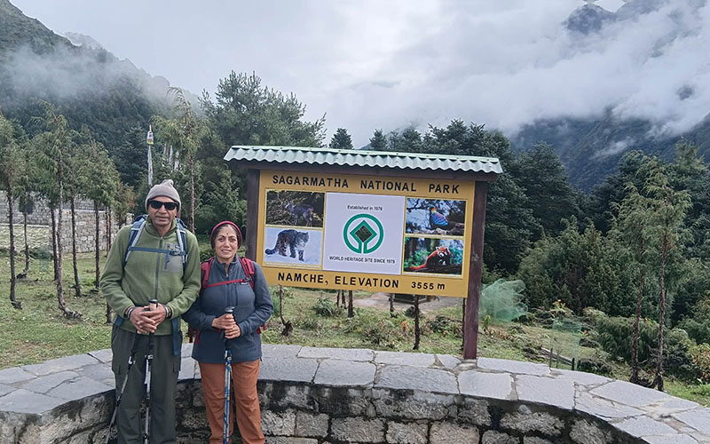
A Message From Himalayan Glacier
For more than three decades, Himalayan Glacier Adventure and Travel has welcomed travelers from around the world to Nepal and the Himalayas.
This disaster is deeply personal for our tourism community.
But Nepal is resilient.
- Our guides are still guiding.
- Our hotels are welcoming guests.
- Our mountain communities are preparing for autumn.
- Our trekking trails across most of the country remain alive with travelers.
- Our adventure industry continues.
Nepal is open. The Himalayas are waiting.
Frequently Asked Questions
Yes – for the large majority of Nepal’s trekking routes. The August 26, 2026 flash flood affected only the Rasuwa district in northern-central Nepal, specifically routes accessing Langtang Valley region. Everest Base Camp, Annapurna Circuit, Annapurna Base Camp, and Upper Mustang are entirely unaffected. These four major regions account for more than 80 percent of all trekking permits issued in Nepal annually, and all are operating normally.
No. Everest Base Camp treks are not cancelled and were not affected by the 2026 Nepal-China border floods. The Everest region lies in the Koshi basin in eastern Nepal – a different river system entirely from the Bhote Koshi and Trishuli corridors that flooded in Rasuwa district. Flights to Lukla, trail access, teahouse accommodation, and guide operations are fully normal. The standard 14-day Everest Base Camp trek with Himalayan Glacier Adventure is available from USD 2,999 per person.
The Langtang/Kyanjin Valley destination remains a trekking area, but access through the affected Trishuli–Rasuwa corridor has been disrupted. TAAN reported that Langtang/Kyanjin Valley remained safe while the access corridor was affected. Trekkers should obtain current access confirmation before travelling.
The exact cause remains under investigation.
Preliminary assessments indicate that an ice avalanche may have blocked the Lhende River, creating a temporary debris-dammed lake that subsequently burst. The resulting surge entered the Bhote Koshi system and travelled downstream through the Trishuli River. It should not currently be described as a confirmed GLOF originating from the Tibetan Plateau.
Not automatically.
If your itinerary passes through the affected Rasuwa/Trishuli corridor, you should obtain a route-specific update and be prepared for changes. If you are travelling to Everest, Annapurna or Upper Mustang, the August 26 Rasuwa flood did not directly affect those main trekking trails. Nevertheless, check current transport, weather and local conditions before departure.
All standard trekking permits remain valid and are being issued normally by Nepal’s Department of Tourism. TIMS (Trekkers’ Information Management System) cards, Sagarmatha National Park permits for the Everest region, and ACAP (Annapurna Conservation Area Project) permits are all being processed without disruption. The Restricted Area Permit (RAP) for Upper Mustang is also being issued normally. Only the Rasuwagadhi crossing permit for the Kailash Mansarovar overland route is currently suspended due to border infrastructure damage.
Plan Your Nepal Trek With Confidence
Himalayan Glacier Adventure has operated on the ground in Nepal since 1992, with a US support office in Baltimore, MD. Flexible rebooking, honest situation updates, and local expertise every step of the way.
For trek-specific details, availability, and current pricing for Nepal’s open trekking routes, visit the following pages on himalayanglacier.com
- Everest Base Camp Trek – 14 Days from USD 2,999
- Annapurna Circuit Trek – 17 Days from USD 3,16
- Upper Mustang Trek – 17 Days from USD 4,540
Sources
- Ministry of Home Affairs, Government of Nepal: Official information on the August 26, 2026 Bhote Koshi flood and affected districts.
- Department of Hydrology and Meteorology, Government of Nepal: Hydrological and meteorological information concerning the flood event.
- Nepal Tourism Board: Tourism and trekking-route updates following the Rasuwa flood.
- World Health Organization (WHO) Nepal: Situation updates on the 2026 Rasuwa flash floods and affected districts.
- The Kathmandu Post: Reporting and expert analysis of the geological and hydrological sequence behind the Rasuwa flood.
Important Disclaimer
Route and access conditions can change rapidly following a major natural disaster. This article reflects information available as of September 1, 2026, and should not be treated as a substitute for official government notices or a route-specific assessment immediately before departure. Travelers should confirm current road, trail, weather, permit and transportation conditions with their trekking operator and relevant Nepal authorities.
Himalayan Glacier recommends checking route conditions within 72 hours of departure and following all instructions issued by local authorities.